Kentucky Mountain Land: 100 Unrestricted Acres With Utilities, Hardwood Timber, and Mineral Rights for $189,500

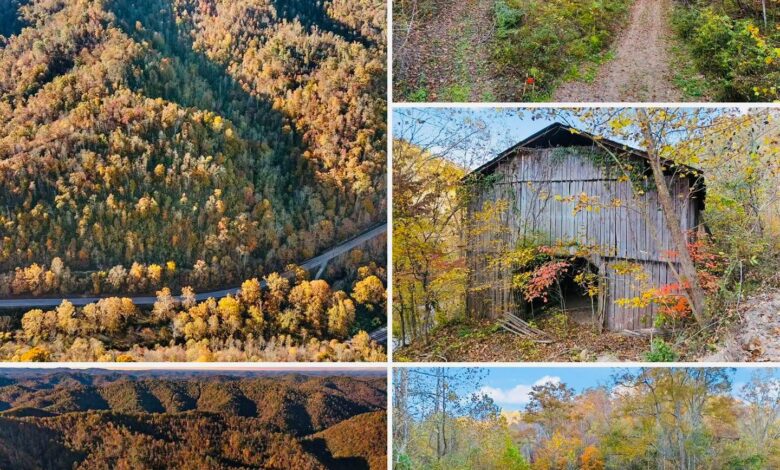
100 Acres in Kentucky Listed for $189,500 With a Stream, Waterfalls, and Existing Barn
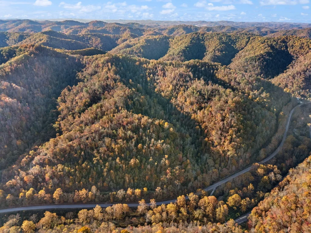
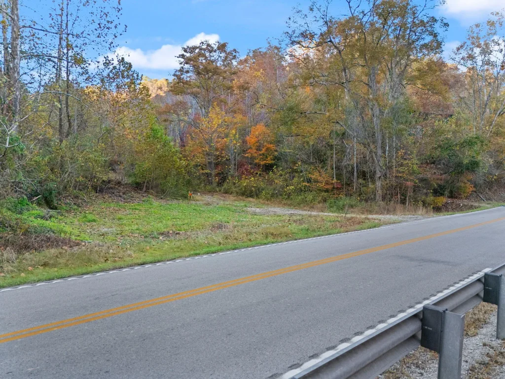
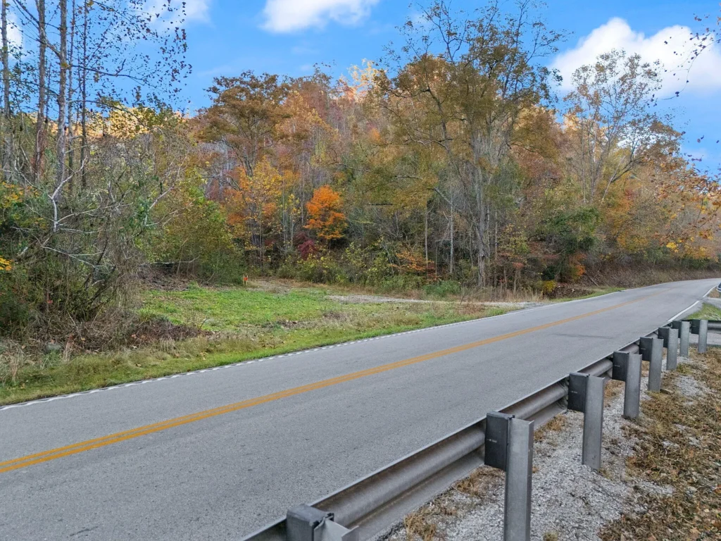
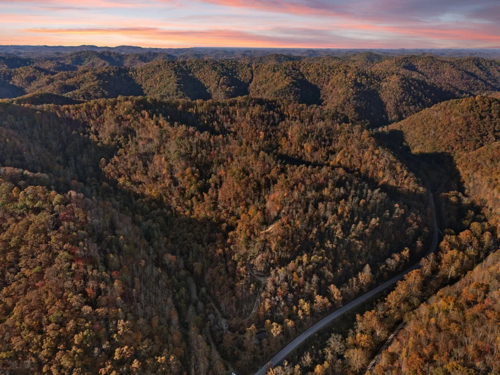
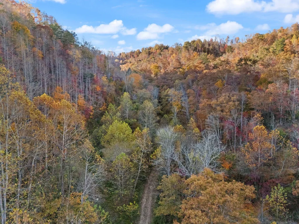
A 100-acre tract along South Kentucky Highway 11 in Manchester, Kentucky, is listed for $189,500, offering a combination of mountain terrain, valley bottomland, mature hardwood timber, and several existing infrastructure features. Located in Clay County, the property is described as unrestricted land with direct highway frontage, a wooden barn, water meters reportedly installed on site, and utility infrastructure available near the road.
The asking price works out to $1,895 per acre based on the stated 100-acre size. Natural features reportedly include a year-round stream running through the valley and two seasonal waterfalls, while the varied terrain offers a mix of flatter ground and steeper mountain slopes.
Listed on April 22, 2026, the property may interest buyers considering a rural homestead, agricultural use, recreational acreage, or a long-term land investment. The listing information also mentions partial mineral rights and the possibility of purchasing two neighboring tracts, potentially expanding the combined holding to approximately 165 acres.
Despite these features, prospective buyers should verify the exact boundaries, utility connection status, permitted uses, septic feasibility, and mineral rights before deciding whether the property fits their plans.
Property Overview: 9992 South KY Highway 11
The property is identified as 9992 South KY #11, Manchester, Kentucky 40962, in Clay County. The supplied parcel identification number is 0570000025.00.
According to the listing details, the tract covers approximately 100 acres and combines accessible lower ground with more elevated, wooded terrain. The property is described as unrestricted, although buyers should confirm the precise meaning of that designation and any applicable state, county, environmental, building, or subdivision requirements.
Reported features include:
- Approximately 100 acres of land.
- Direct frontage along South Kentucky Highway 11.
- Flatter valley bottomland and steeper mountain slopes.
- A year-round stream and two seasonal waterfalls.
- Mature hardwood timber.
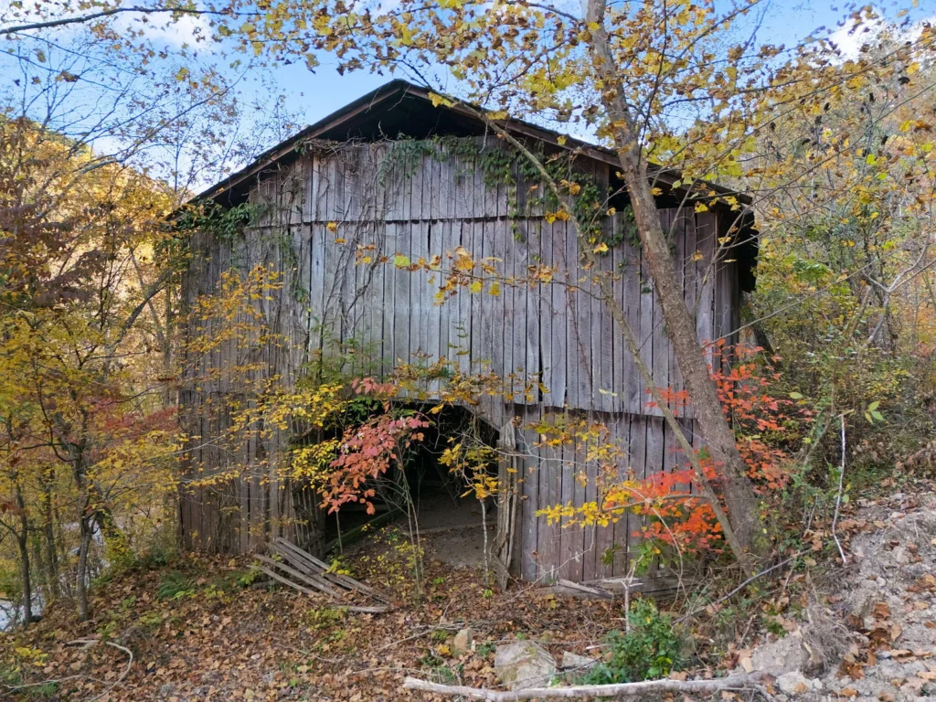
- An existing wooden barn.
- Public water meters reportedly installed on site.
- Utility poles already set, according to the supplied information.
- Natural gas and fiber internet availability along the road.
- Partial mineral rights reportedly included in the sale.
- Potential to purchase two adjoining tracts of 32 and 33 acres.
The combination of highway frontage, varied terrain, and existing improvements could make the property worth investigating for several different uses. However, the listing does not establish that every part of the acreage is suitable for construction or that all nearby utilities are active and ready for immediate use.
Asking Price and Per-Acre Value
At $189,500 for 100 acres, the calculated asking price is $1,895 per acre. This provides a simple basis for comparison with other land listings in Clay County and surrounding areas.
| Property metric | Reported or calculated figure |
|---|---|
| Asking price | $189,500 |
| Reported acreage | 100 acres |
| Calculated price per acre | $1,895 |
| Parcel ID | 0570000025.00 |
| Listing date | April 22, 2026 |
| Estimated annual property taxes | $400–$650 |
| Estimated monthly property taxes | $33.33–$54.17 |
| HOA dues | None reported |
The per-acre calculation is based on the supplied acreage and asking price. It is not an appraisal, and the actual value will depend on the property’s verified boundaries, usable acreage, access, infrastructure, timber, water features, and legal rights.
The parcel’s mix of flatter land and steep slopes is particularly relevant. One hundred acres of mountainous terrain may offer privacy and recreational value, but the amount of land suitable for homes, barns, driveways, septic systems, or agricultural operations could be considerably smaller than the total acreage.
A boundary survey and a site assessment would help buyers distinguish the property’s total area from the ground that can practically support their intended activities.
Existing Infrastructure and Highway Access
One of the reported advantages of the property is its frontage along South Kentucky Highway 11. Direct highway frontage can simplify access compared with a remote parcel that depends on a private road or an unrecorded access arrangement.
Nevertheless, buyers should confirm the legal status of the frontage, any applicable highway access restrictions, and whether driveway locations or changes to existing entrances require approval.
The listing also describes water meters and utility poles already installed on the property. Natural gas and fiber internet are reportedly available along the road.
These features could reduce some of the work required to establish services, but their exact status matters. A water meter does not necessarily establish that water is flowing or that a service line reaches every proposed building location. Similarly, utility poles on site do not guarantee that an active electrical connection is available at the intended point of use.
Before budgeting for construction, buyers should contact the relevant water district, electric cooperative, natural gas provider, and internet provider to confirm:
- Whether service is active or merely available.
- Where existing meters and connection points are located.
- Whether additional installation, inspection, or connection fees apply.
- Whether the infrastructure has sufficient capacity for the intended development.
- Whether extending services to a more remote building site would require additional work.
These checks are especially important if the plan involves multiple buildings, a larger residence, agricultural equipment, or several rental cabins.
Valley Bottomland, Mountain Slopes, and Buildable Areas
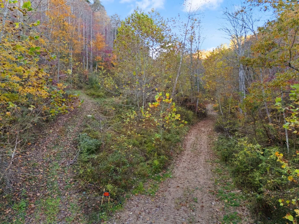
The property is described as having several distinct terrain zones, including flatter bottomland along the highway and steeper wooded slopes rising toward the surrounding mountains.
The lower ground may be the most practical area to investigate for a primary residence, barn, garden, driveway, or other improvements. Flatter terrain can simplify construction, although drainage, soil conditions, flood risk, and access to utilities still need to be assessed.
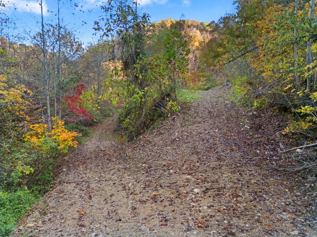
Higher ground may offer additional privacy, scenic views, and opportunities for hiking or other outdoor recreation. However, steep slopes can make excavation, road construction, foundations, and utility installation more expensive.
The total acreage should therefore not be interpreted as 100 acres of equally usable land. A site visit with a qualified surveyor, engineer, or other relevant professional can help identify potential building locations and determine where slopes or drainage features could constrain development.
Buyers should also investigate whether any portion of the bottomland lies within a flood-prone area. The presence of a stream does not establish that the property floods, but it does make drainage and floodplain review important before placing permanent structures near the water.
A Year-Round Stream and Two Seasonal Waterfalls
The listing identifies a year-round valley stream and two seasonal waterfalls as prominent natural features. These elements could add scenic interest and recreational appeal, particularly for buyers seeking a rural retreat or a property with varied landscapes.
The stream may also provide habitat for wildlife and contribute to the character of the valley. However, its presence should not be treated as proof of a legal right to withdraw water, build a pond, alter the stream channel, or use the water for household or agricultural purposes.
Water rights, environmental requirements, stream setbacks, and any restrictions on construction or land alteration should be confirmed with the appropriate authorities before making plans that affect the watercourse.
The waterfalls are described as seasonal, meaning their flow may vary depending on rainfall and weather conditions. Buyers should inspect them at different times if their importance to the purchase decision is substantial.
Any proposed cabins, trails, crossings, or recreational facilities near the stream should be evaluated for erosion, drainage, safety, and applicable environmental requirements.
Mature Hardwood Timber and Potential Land Uses
The tract reportedly contains mature hardwood timber, which may contribute to its natural appeal and could have potential forestry value. The actual value of the timber cannot be determined from the description alone.
A qualified forester would need to evaluate the species, tree sizes, stand density, timber volume, condition, accessibility, and prevailing market conditions before estimating potential stumpage value. Logging costs and access for equipment would also influence the economics of any timber harvest.
For buyers who do not intend to harvest timber, the wooded areas may provide shade, wildlife habitat, and privacy. Those interested in agriculture or homesteading could investigate whether the lower ground is suitable for gardens, pasture, or other uses.
The property’s varied terrain could also appeal to recreational buyers, but any plans for hunting, trails, camping, or other activities should be checked against applicable laws and restrictions. The listing’s description of the land as unrestricted should not be interpreted as a guarantee that every proposed use is permitted.
The Existing Wooden Barn
An existing wooden barn is another reported feature. Depending on its condition, size, and layout, it might provide storage for tools, equipment, or supplies.
Before assigning substantial value to the structure, buyers should inspect its foundation, framing, roof, siding, doors, and floor. The supplied information does not establish its age, dimensions, structural condition, or whether it is suitable for livestock or equipment storage.
If the barn requires repairs, the cost should be included in the overall purchase budget. Buyers should also determine whether permits or inspections would be required for substantial renovation or a change in use.
The barn may be useful as part of a rural property, but its practical value depends on what it can safely accommodate and how close it is to the intended work area or building site.
Public Water, Electricity, Natural Gas, and Fiber Internet
The reported utility infrastructure is a potentially important part of the listing. Water meters and utility poles are said to be installed, while natural gas and fiber internet are described as available along the road.
For buyers planning a home or multiple buildings, these details may make the property more convenient than completely undeveloped land without nearby infrastructure.
However, service availability should be verified independently. Buyers should request confirmation from each provider, including information about active connections, connection fees, service boundaries, and the cost of extending utilities to specific locations on the parcel.
The terrain may also affect installation costs. A building site farther up a slope or away from the highway could require longer utility runs, additional trenching, or engineering work.
The supplied information does not confirm that the property has a completed septic system. If public sewer is unavailable, a suitable on-site wastewater system may be required. Soil testing and approval from the appropriate local authority would be necessary before relying on a particular building location.
Partial Mineral Rights Require Careful Review
The listing states that partial mineral rights convey with the property. This could be relevant to buyers interested in retaining the property’s subsurface interests, but the wording requires clarification.
Mineral rights can be separated from surface ownership, and the rights conveyed may differ across portions of a tract. Buyers should not assume that all mineral interests are included simply because some are described as conveying.
A Kentucky real estate attorney should review the deed, title history, and any existing mineral reservations or leases. The review should identify which interests are included, whether they cover the entire parcel, and whether any third-party rights affect the land.
The existence of mineral rights does not guarantee that commercially recoverable resources are present or that exploration or extraction would be permitted. Any potential value should be assessed separately from the surface land and should not be treated as guaranteed income.
Could the Property Support a Homestead or Multi-Cabin Retreat?
The property may interest buyers considering a private residence, rural homestead, recreational retreat, or small-scale cabin project. Its reported highway frontage, existing barn, utility infrastructure, and mix of open and wooded terrain provide several features worth investigating.
A phased development approach could be possible if the intended uses are permitted and the land has suitable building sites. For example, a buyer might first evaluate the lower ground for a primary residence and essential utilities, then consider additional improvements after confirming the costs and approvals involved.
A multi-cabin retreat would require more detailed planning. Buyers would need to investigate access, setbacks, wastewater capacity, fire safety, utility service, parking, building permits, and any rules governing short-term rentals or commercial activities.
The word “unrestricted” in a listing does not eliminate state laws, building codes, environmental requirements, or other applicable regulations. Written confirmation from the relevant local authorities is important before relying on a particular development plan.
Potential to Expand to Approximately 165 Acres
The supplied listing information mentions two neighboring tracts, reportedly containing 32 acres and 33 acres, that may be available for separate purchase. If all three properties could be acquired, the combined acreage would total approximately 165 acres.
This could interest buyers seeking a larger contiguous holding for privacy, recreation, forestry, or a more extensive rural property. However, the additional parcels should be evaluated independently rather than assumed to be available on the same terms.
Prospective buyers should confirm the current listing status and asking prices of the adjoining tracts, whether their boundaries connect directly, and whether they have separate access and utility arrangements.
A combined purchase would also require reviewing each parcel’s title, mineral rights, restrictions, taxes, and physical characteristics. More acreage does not automatically mean greater usability, especially where steep terrain or access limitations are present.
The supplied listing references MLS numbers 26008614 and 26008686 for the additional tracts. Their current availability and details should be confirmed with the listing representative.
Property Taxes and Ongoing Ownership Costs
The supplied information estimates annual property taxes at approximately $400 to $650, equivalent to about $33.33 to $54.17 per month when averaged over a year. No HOA or landowner dues are reported.
These figures suggest that the reported property-tax burden may be modest relative to the size of the tract. However, the current tax bill and assessment should be verified through the Clay County Property Valuation Administrator or other appropriate county records.
Ownership costs would also depend on how the land is used. Expenses could include mowing or clearing, maintaining access points, repairing the barn, managing timber, maintaining drainage, installing utilities, and paying for surveys or professional inspections.
If the buyer develops the land, additional expenses could include engineering, permits, excavation, foundations, septic installation, and utility extensions. These costs should be budgeted separately from the purchase price.
For a long-term landholding, buyers should consider both annual carrying costs and the cost of keeping the property accessible, safe, and consistent with the intended use.
Comparing the Asking Price With Other Land Listings
At $1,895 per acre, the property provides a clear starting point for comparing it with other acreage listings in Clay County and neighboring areas. However, no verified comparable-sale data has been provided to establish that this price is below the local market.
A meaningful comparison should account for acreage, highway frontage, the amount of usable bottomland, slope, timber quality, existing structures, utility availability, water features, and mineral rights.
A parcel with extensive steep terrain may have a different per-acre value from one with a larger proportion of level ground. Similarly, installed utility infrastructure may reduce some development costs, but only if the connections are usable and the services can be extended to the intended building sites.
Recent completed sales are generally more useful than asking prices alone. Buyers may wish to consult a qualified local land agent or appraiser who understands rural properties and can evaluate the parcel’s particular characteristics.
The $1,895-per-acre calculation is therefore a useful comparison metric, not a conclusion about fair market value or future appreciation.
Essential Due Diligence Before Purchasing
Before submitting an offer, buyers should investigate the following:
- Commission a boundary survey. Have a licensed Kentucky surveyor establish the property lines, verify the acreage, and identify the locations of the stream, barn, access points, and neighboring parcels.
- Review the title and mineral rights. Work with a real estate attorney to establish exactly which mineral interests convey and whether prior reservations, leases, or other rights affect the property.
- Verify water and electric service. Contact the local water district and electric cooperative to confirm meter status, connection requirements, fees, and the locations served by existing infrastructure.
- Confirm natural gas and fiber availability. Ask the relevant providers whether service can be connected at the intended building site and obtain any applicable installation estimates.
- Evaluate septic feasibility. Arrange for appropriate soil testing and review the requirements for an approved wastewater system before committing to a building location.
- Assess flood and drainage conditions. Review available flood maps and have low-lying ground near the stream evaluated where necessary.
- Inspect the barn. Determine whether the structure is safe and usable or requires repairs, reinforcement, or replacement.
- Verify zoning and development permissions. Confirm the permitted uses of the parcel and the rules affecting homes, cabins, agricultural operations, subdivision, and any commercial or rental activity.
- Obtain forestry advice if relevant. A qualified forester can assess the timber and help determine whether management or harvesting would be practical.
- Investigate the adjoining parcels. Confirm availability, pricing, legal access, boundaries, and title details before planning a combined 165-acre holding.
Final Thoughts on the 100-Acre Kentucky Property
Listed for $189,500, this reported 100-acre property along South Kentucky Highway 11 in Manchester offers a combination of mountain terrain, valley bottomland, mature hardwood timber, a wooden barn, and natural water features. The calculated price of $1,895 per acre provides a useful starting point for evaluating the asking price.
Reported water meters, utility poles, and nearby natural gas and fiber infrastructure may also be attractive to buyers who want to investigate future development without starting entirely from scratch. The year-round stream and seasonal waterfalls add to the property’s recreational appeal, while partial mineral rights could be relevant to buyers interested in subsurface ownership.
The important questions are how much of the land is practically usable, whether the utilities are active and accessible at the desired locations, what mineral rights actually convey, and whether the intended construction or recreational use is permitted. The existing barn, stream corridor, and steep slopes also warrant on-site assessment.
For buyers seeking a larger rural holding, the property may be worth investigating, particularly if the adjoining parcels are genuinely available and suitable for the same purpose. However, the asking price should be evaluated alongside verified boundaries, development costs, and comparable land sales rather than acreage alone.
This article is based on the supplied listing information and has not been independently verified. Acreage, taxes, utility status, mineral rights, permitted uses, neighboring parcel availability, and other property details should be confirmed with the relevant authorities and qualified professionals before purchase.
Listed on Zillow